DESCRIPTION
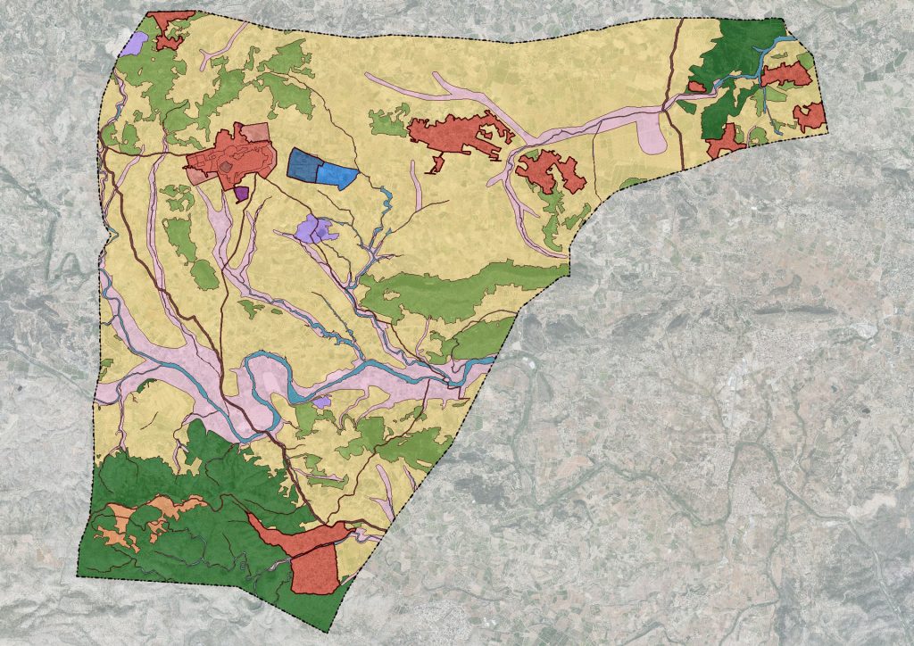
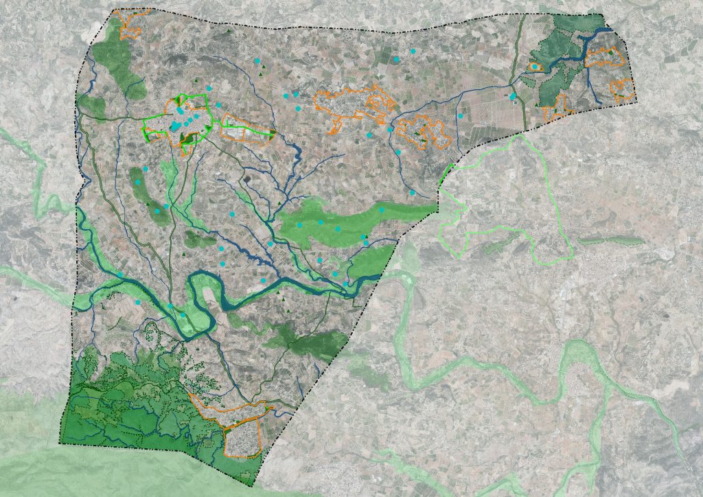
The municipality of Turís is located in the Valencian Community, in the province of Valencia, 34 kilometers from the capital. It belongs to the region of La Ribera Alta, situated to the north of it. This region, made up of 35 municipalities, occupies an area of 970 km² and welcomes an approximate population of 22 5,000 inhabitants, so its average population density corresponds to 231.5 inhab/km². To this figure, Turís , with a population density of 81.83 inhab/km², contributes 2.93% of the population, with 6,646 inhabitants (2019) and 98.30% of surface, 80.51 km².
Being a traditionally agricultural area, during the last decades in Turís not only a polynuclear system of occupation of the territory was established, based on randomly arranged urbanizations, but the practice of illegal occupation of land by single-family homes was consolidated and not It was only a few years ago that the seriousness of this problem was realized. An unstructured model and in which the main loser has been the main (and traditional) urban area, in the form of a shortage of public infrastructure and green spaces, is the context in which the drafting of this plan had to be addressed.
When AUG-ARQUITECTOS, SLP took over the drafting of the general plan, the city council had been trying for more than ten years with another drafting team to carry it out. In its course, different versions of the plan have been processed before the environmental body (which did not even exist as such, when it began to be drafted), characterized in all previous cases, by proposing much higher growth thresholds than those finally have been presented . These expectations, undoubtedly orphaned by an objective justification and arisen in the midst of the “urban whirlpool”, have been tempered until reaching a point of balance .
The philosophy that inspires this plan, aims to collect the indications formulated by the General Director of Territorial Planning, Urban Planning and Landscape of the Valencian Government , in a document addressed to all the municipalities of the Valencian Community in which he recalled that “ the land it is a limited asset that must be used efficiently and rationally, which has been squandered by the expansive urban model, sealing and linking to certain uses a large amount of land that is detracted from primary activities and the territorial and environmental functions they exercise ” , to conclude that ” in this situation it is necessary to act “.
Consequently, the strategic guidelines for the planned development are as follows :
- Expansion of the components of the Green Infrastructure, previously identified in the information phase and joined not only by those that the PGE interprets as such, but also those that will be generated as a result of the development of the PGE and POP determinations
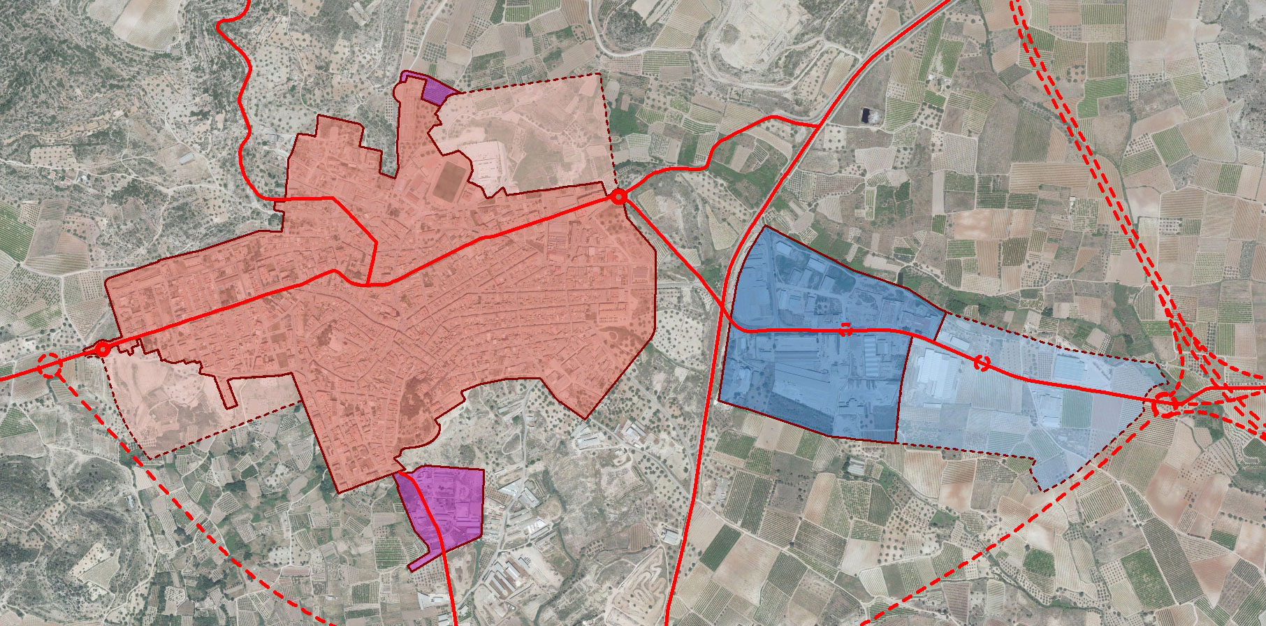
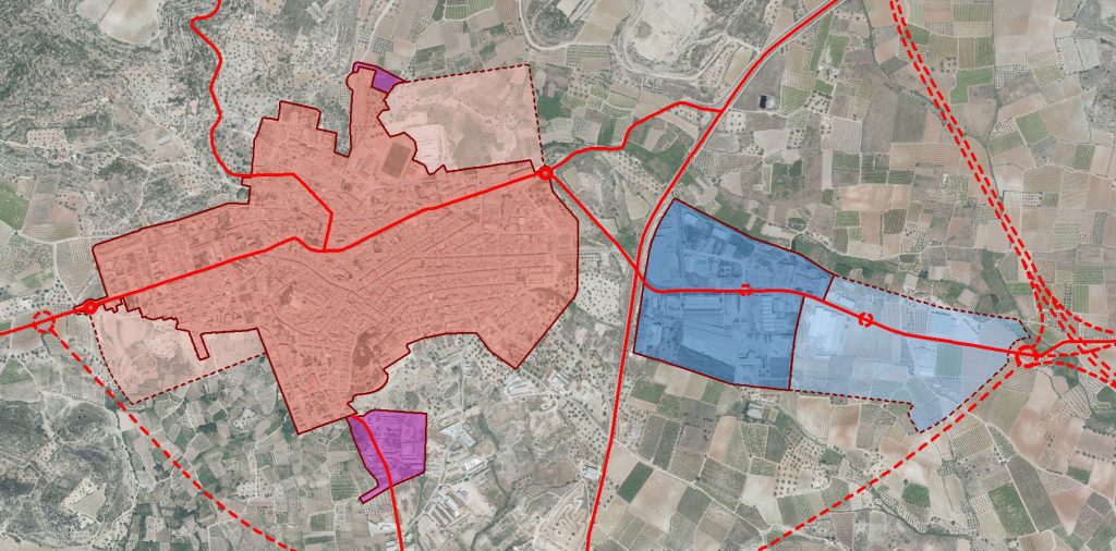
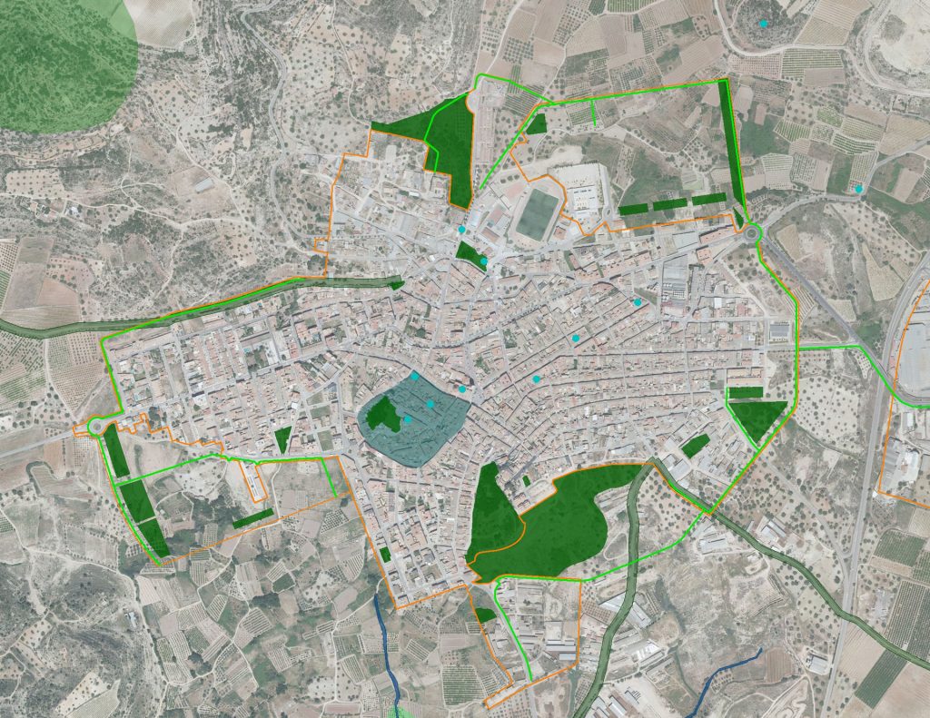
- Establishment of a proposal for the management of the Turís nucleus, oriented to the structuring of the existing urban land and to the implementation of the regeneration and comprehensive urban renewal operations, carried out in the areas of “La Mina” and “Lepanto”, supplementing their endowments and locating possible growth scenarios in areas contiguous to the urban area or in degraded areas, capable of hosting regeneration operations and comprehensive urban renewal. In this arrangement, urban mobility has been considered as a determining factor in the design, which translates into the “cortical” nature of the three new growth areas and in the design of the road sections, which enable both vehicle traffic and bicycles or on foot, in appropriate conditions.
- Rigorous delimitation of urbanizations, ascribing to the regime of integrated actions those soils that are not consolidated urbanization and trying to rationalize the complex framework of pre-existing, developed outside the law – in certain cases – and against a rational criterion of land occupation, in almost all cases. This section includes the reclassification to urban land pending planning and programming of the Canyapar urbanization, in order to seek a possible way out of the blockade that persists in this area since the approval of the NNSS, as its development as land is unfeasible. developable.
- Identification and delimitation of areas in rustic or undeveloped land, subject to Territorial Impact Minimization Actions , including both built plots and those that are not, but whose membership in this regime is essential for the correct structuring of the territory, for a better and more rational delimitation of this type of areas and for the execution of the urban infrastructures and services that are intended to be implemented through the corresponding Special Plans and Urbanization Projects.
- Provision of an updated cartography, from which and by exclusion, to all the buildings that are not in any urban area, the restitution regime of the corresponding urban planning legality should be applied, taking into account the inexcusable nature of the exercise of the power.
- Rustic or undeveloped land management, taking into consideration the agricultural wealth of the area and the detailed delimitation that the municipal technical services have provided of the forest land and consolidating the agricultural values of the territory.
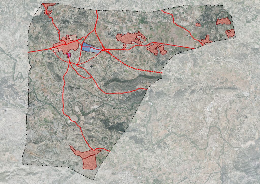
- Incardination in the proposal of the large existing and proposed infrastructures , including the forecast of the new roadways and the large hydraulic infrastructures, which will come to alleviate the water deficit that the municipality currently has, despite the availability of resources . With this plan, in addition, a parallel study of evaluation and access to these water resources is promoted, essential to overcome the current situation regarding this issue, characterized by the dispersion of suppliers and the submission to their demands.
- In the case of the Turís nucleus, the only one for which a growth in residential use is proposed, this growth constitutes the (essential) basis for balancing public endowment land reserves, which currently present significant deficits, above all, of green areas. But at the same time that these actions are proposed, a reduction of the residential building in part of the urban area is proposed , recovering the typology of three heights, characteristic of the turisana architecture. This is achieved, not only to stop the urban degradation that in recent years has led to the execution of exaggerated buildings and out of context, but to reduce the potential housing ceiling and meet citizen expectations, contained in the Public Participation Plan. And collaterally, the municipal coffers are relieved of the need to acquire and execute new endowment land, especially primary network parks, the cost of which would have been unaffordable.
- Application of ordinances adjusted to vernacular architecture (collected in relation to urban land in the PGP), with which it is intended to reconcile the maintenance of the resident population in the Historic Nucleus, with the safeguarding of the typological and compositional features that characterize the local architecture.
- The elaboration of a wide Catalog of Protections that incorporates measures to value and preserve heritage, understood in a broad sense .
Regarding the comprehensive urban renewal operations that are proposed for two degraded areas, it must be emphasized that we understand comprehensive urban rehabilitation to be that intervention that considers jointly and in coordination environmental recovery, urban and building renovation and regeneration, and improvement of the economic and social conditions of citizens. Specifically, the following objectives are pursued:
- The reduction of the exorbitant consumption of soil and the recycling of the soil previously used by the urbanization.
- The limitation of urban expansion and the commitment to density, facilitating the reduction of transportation needs.
- Optimization of existing infrastructures, services, facilities and social networks, instead of reproducing them in new developments.
- The reduction of energy consumption, both through the improvement of the energy efficiency of the restored buildings, and the lower transportation needs.
- The promotion of the use of alternative and renewable energy (solar panels, etc.) and the reuse and recycling of waste.
- Reducing the consumption of new materials, to the point that rehabilitating a building can save 60% in energy compared to demolishing and rebuilding it, also avoiding numerous associated environmental impacts.
- The possibility of recycling, and the introduction of greener and healthier materials.
DETAILS OF THE PROJECT
Locality: Turís (Valencia, Spain); Promoter: City Council of Turís; Municipal term area: 8,051 Ha.; Urban Land: 444 Ha.; Able for urbanise Land: 46 Ha.; Not able for urbanise land: 7,561 Ha.; Population cores: 9; Processing status: In process


