
DESCRIPTION
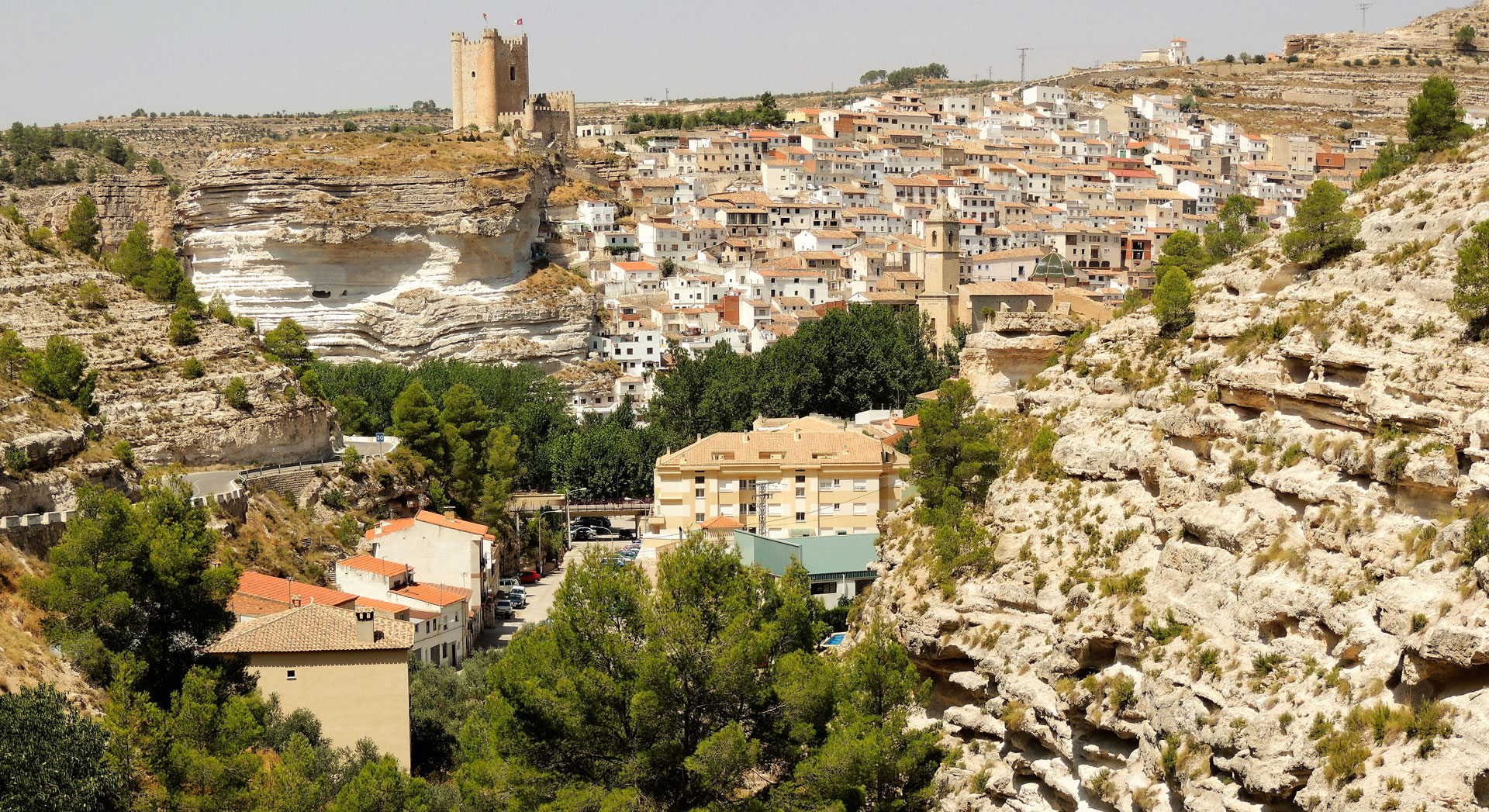
Alcalá del Júcar is a landscape, cultural and tourist reference, not only in the province of Albacete, but at this time, in Castilla La Mancha and throughout Spain, thanks to social networks. This attractiveness has its origin in the values, known for decades, that justified that its urban area was declared a Historic Artistic Complex (CHA) in 1982.
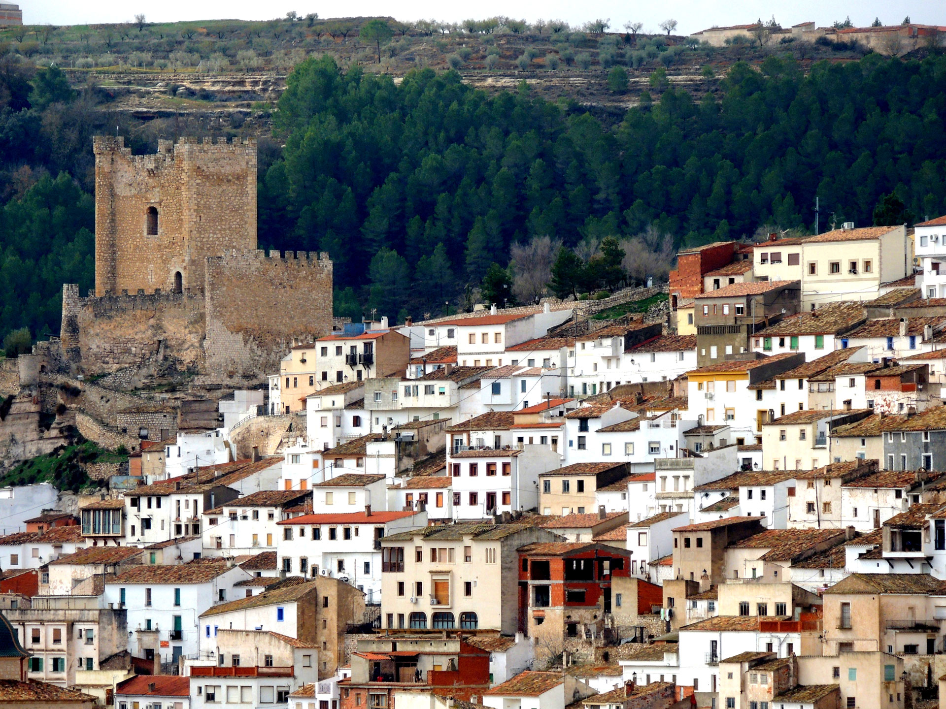
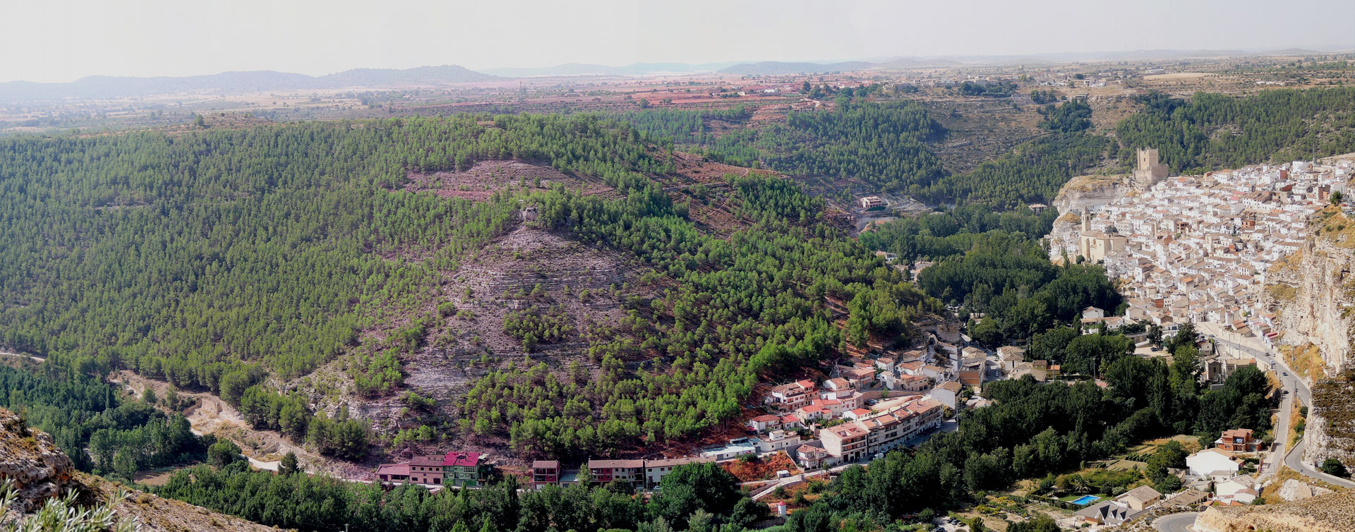
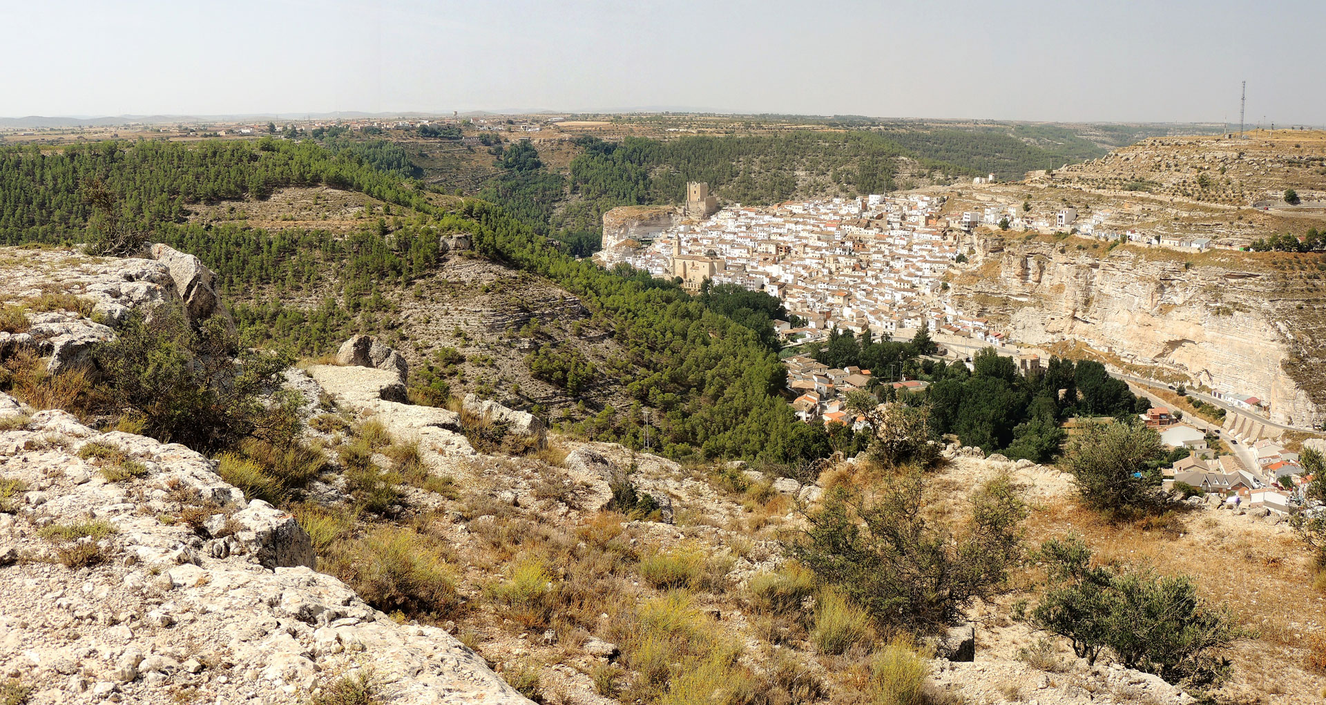
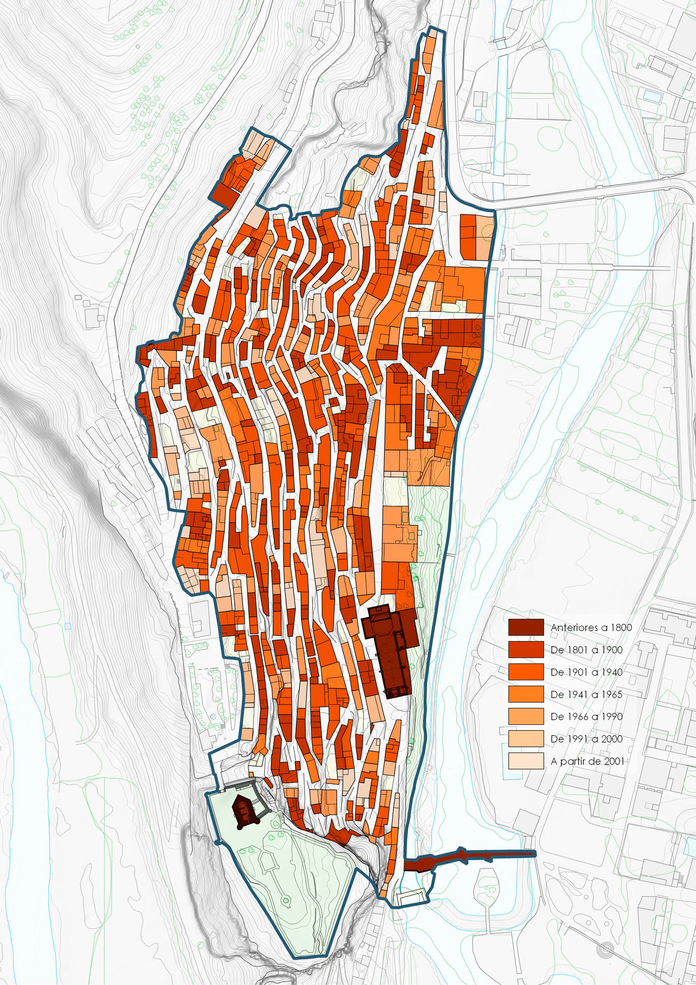
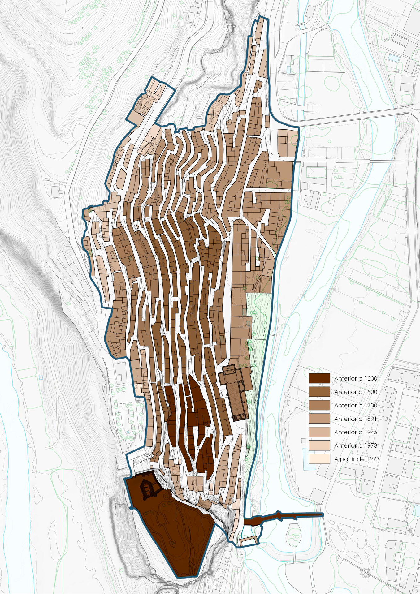
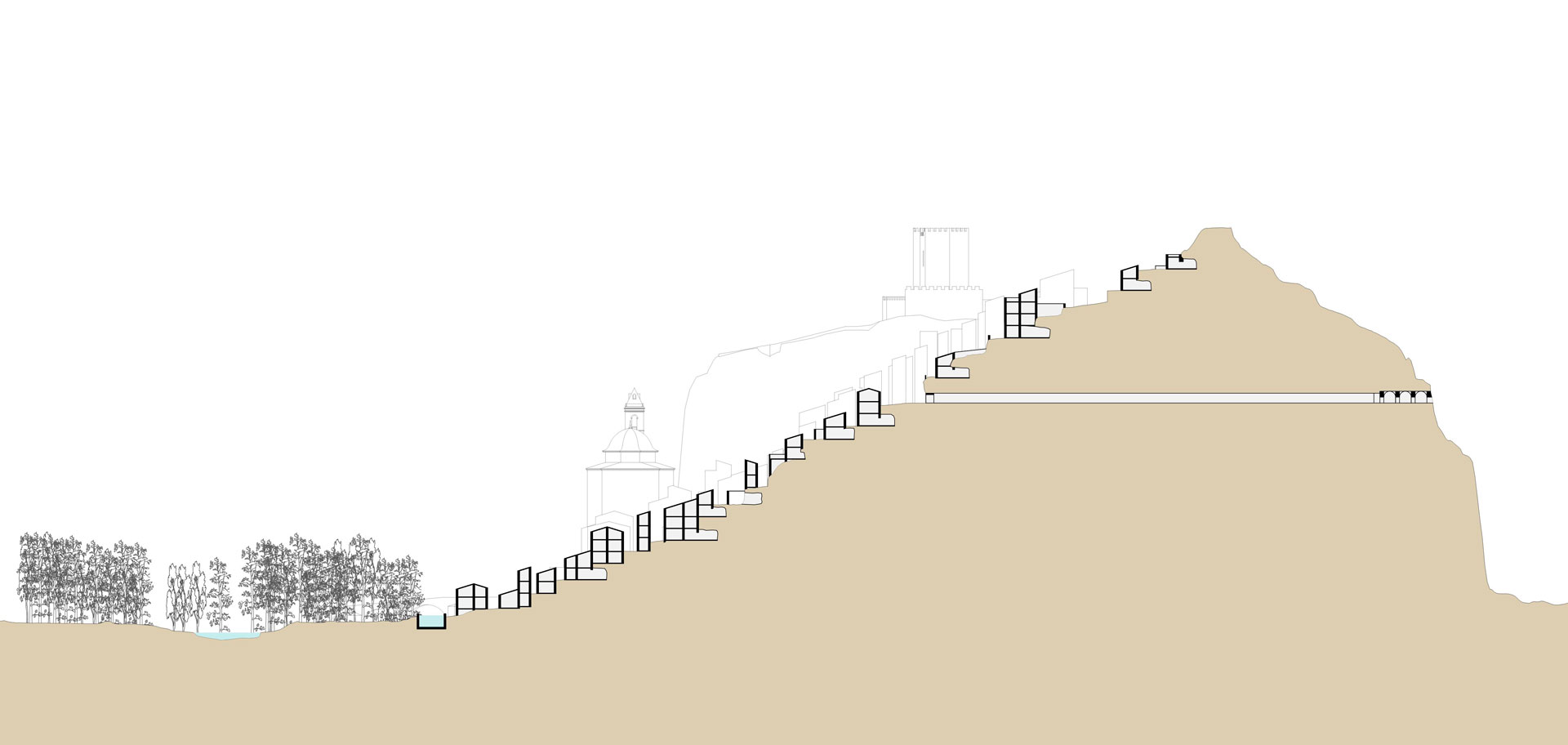
The urban fabric of Alcalá del Júcar is a direct consequence of the geomorphological characteristics of the territory, dominated by a rock formed by a “powerful limestone group of lacustrine origin and Pliocene age, characterized by the alternation of micritic and marly strata, which favors the unleashing of differential erosion processes”. Said rock, in addition, in the framework of the gorges of the Júcar river, presents deforested slopes (although they have recently been repopulated), facilitating both the occupation of the territory and its erosion. In one of the most spectacular meanders of the river, next to the tombolo known as Bolinche de Manazas and on the east side of it, the only one whose relief allows a residential occupation, the population settled in the vicinity of what was originally the fortress. from Muslim times. Using a system of terraces of narrow dimensions, since the abrupt terrain does not favor the creation of platforms of generous dimensions, the first settlers arranged their dwellings, which undoubtedly had to be developed in the cavities and caves excavated in the rock, rather than on the surface. .
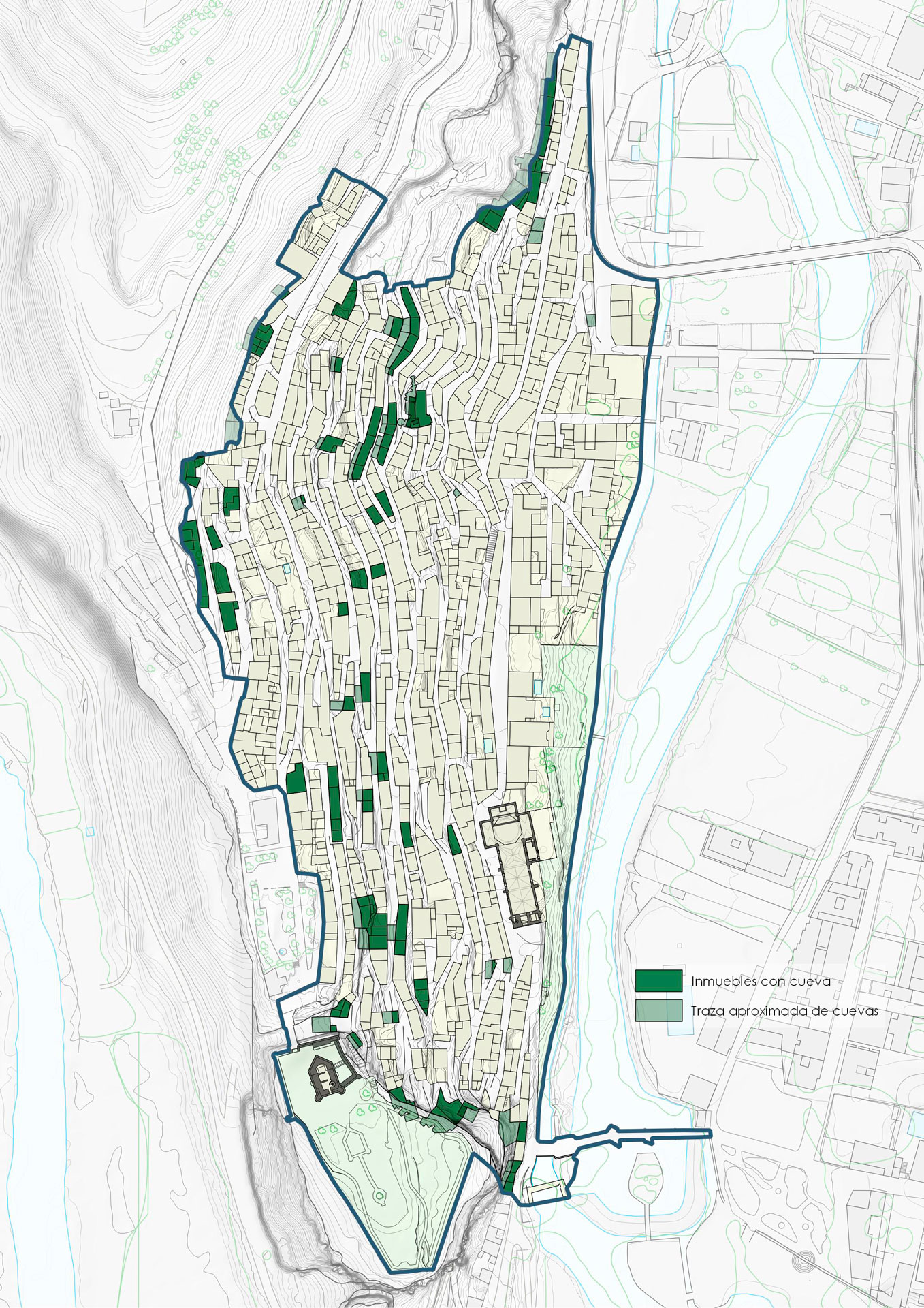
The easy excavation of the support on which the CHA of Alcalá del Júcar is located determined that a system of caves, which would possibly offer a rudimentary system of protection against inclement weather, on the surface, was developing towards the north of the fortress, occupying the eastern slope of the meander. Over time and for the next eight centuries, the primitive caves and paths gave rise to buildings with very simple architectural features and streets, still cobbled until not many years ago.
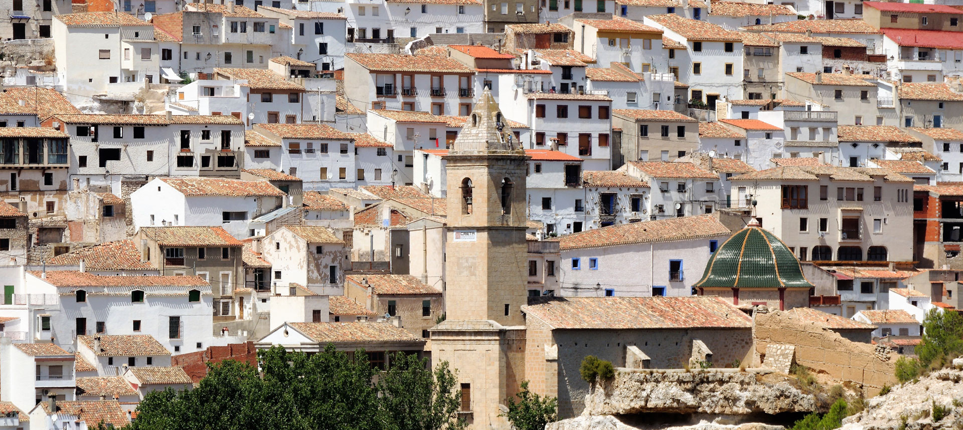
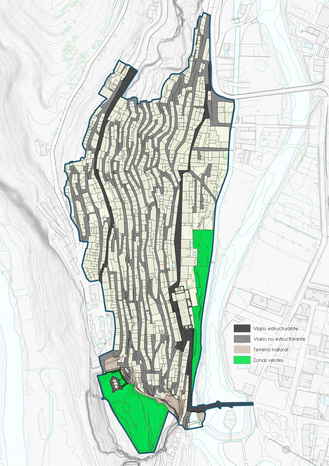
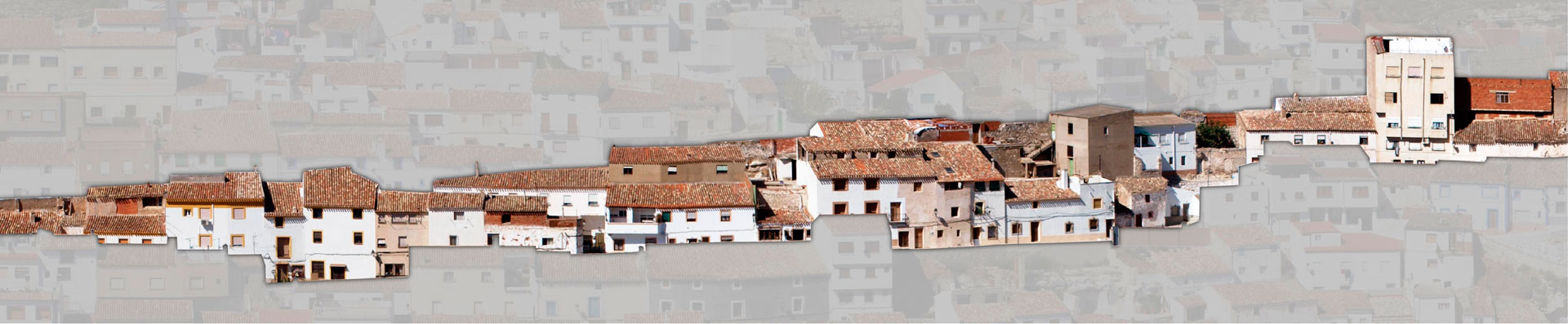
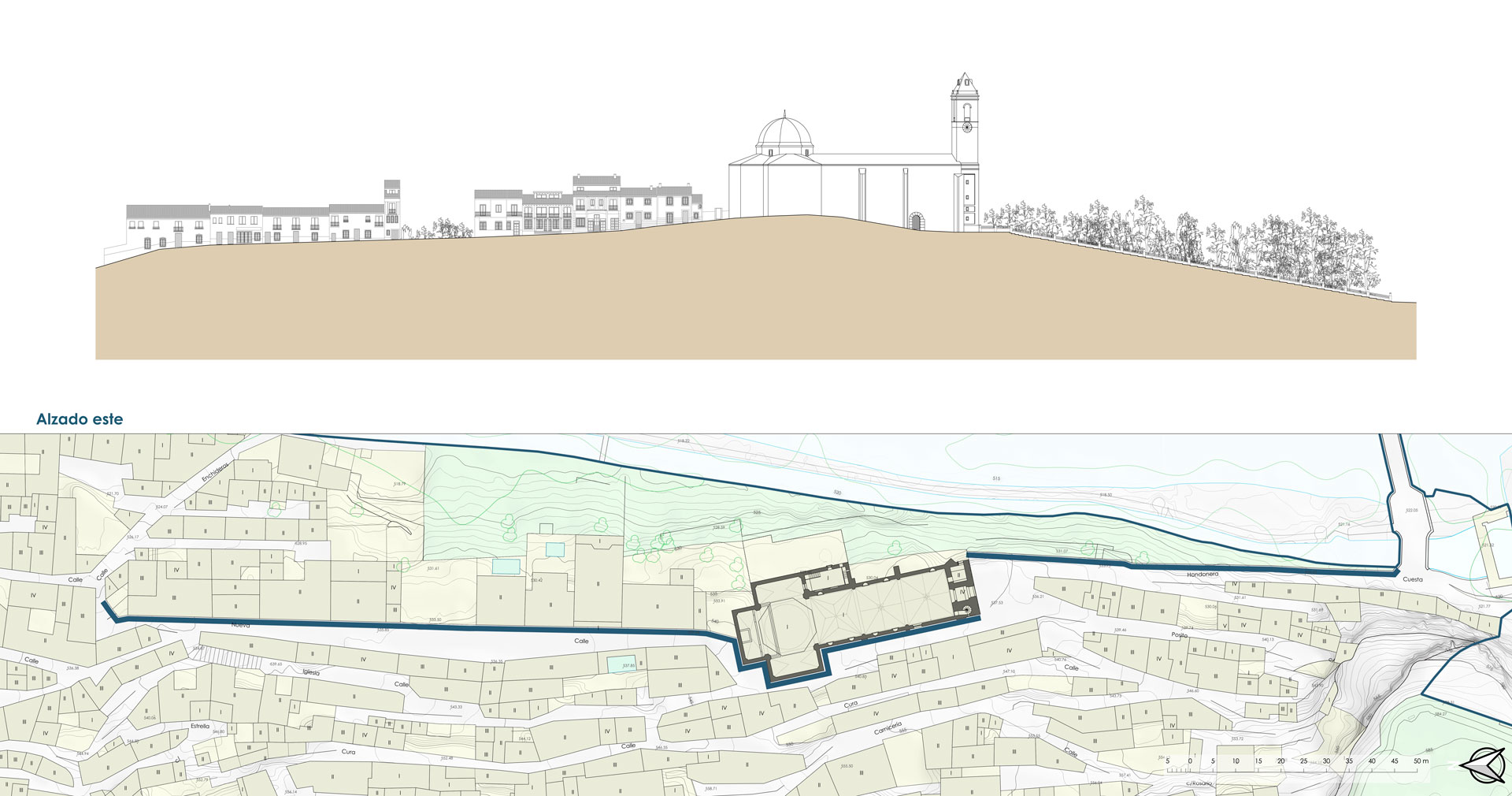
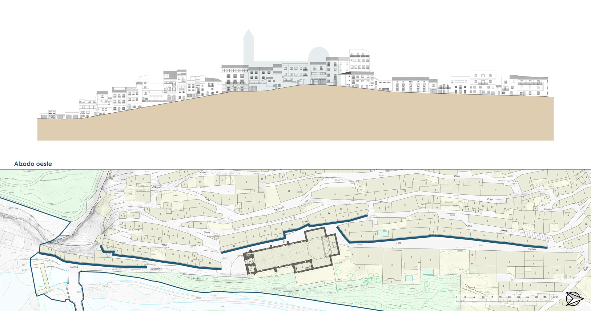
The urban fabric, characterized by buildings of popular architecture that were easily recognizable until the last quarter of the 20th century, is dominated by the silhouette of the castle, located in the southern part of the CHA, in an elevated and impregnable position. The arrangement of the built-up, narrow and long blocks and the narrowness of the streets, among which a motorized vehicle hardly circulates, make up a space where the facades are arranged following the contour lines of the territory and are only interrupted to open narrow high slope, which communicate some levels and others, within the town, in a framework where mobility is not easy and transit involves considerable effort, if it is to be done between positions of different heights.
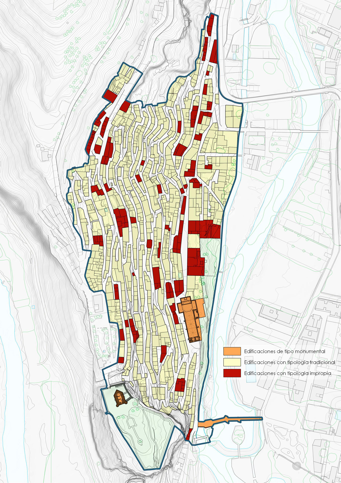
The architecture of the CHA is currently shaped by the succession of forms that result from its historical evolution and the usual contrast in this type of ensemble, between monumental religious and civil architectures (in the case of Alcalá del Júcar, the Castle, the Parish Church of San Andrés, the Roman Bridge and outside its strict scope, the Plaza de Toros) and the simplest architectures, which make up the bulk of the urban fabric of the CHA.
The monumental buildings, rare in this town, are built with stone from nearby quarries, usually limestone or sandstone, combining masonry and ashlar masonry. For its part, in popular architecture, its ability to adapt to the climate, the available materials and the rugged relief stands out, which makes up a scene dominated by the typological harmony of the complex. This aspect is more outstanding than the individual qualities of each of the homes that comprise it.
The Special Plan for the Protection of the Historic-Artistic Complex of Alcalá del Júcar proposes a series of strategic actions, most of which have already been implemented:
- Incorporate Public Participation into the planning and development process, in accordance with the provisions of the Castilian-Manchegan regulatory framework, through surveys on fundamental aspects for the effective development of the proposal.
- Establish specific ordinances for urban planning areas, aimed at preserving heritage and improving the architectural quality of the proposals presented, making the improvement of the housing conditions of the properties compatible with the maintenance of their rural character, their territorial appeal and the urban façade of their buildings, thereby avoiding mortgaging the banalization of their landscapes and the preservation of the identity features of the traditional architecture of the CHA, overcoming the limitations of a building ordinance (that of the current PDSU) that has shown the existence of numerous gaps and inadequate regulatory parameters, which has enabled the proliferation of disrespectful and inappropriate interventions.
- Incorporation of sustainability criteria in building and urban development works.
- Establishment of harmonization measures between the existing traditional architecture identified by the PEPCHA, and new buildings.
- Implement measures in the area of sustainable mobility provided for by the Sustainable Urban Mobility Plan, with special emphasis on those actions aimed at improving mobility conditions in “soft” modes (pedestrian and cycle-tourist routes), reducing and rationalising the use of private cars, park-and-ride parking, etc.
- Significance of residential use as the undisputed protagonist of the CHA, closely related to commercial use, hospitality and catering of rural tourism existing in the municipality.
- Regulation of commercial uses, promoting traditional trade that focuses on the marketing of quality local products based on traditional and/or artisanal production methods, thereby increasing their added value.
- Coordinate synergies between the local tourism sector and the population, to agree on the programming of medium and long-term actions, which allow the implementation of complementary activities to diversify and combat the seasonality of the traditional tourist offer.
- Social sustainability of the actions planned by the Plan, avoiding, in any case, the exclusion of groups at risk.
- Guiding economic evaluation of the set of measures outlined, with a holistic perspective that contributes to improving the quality of urban space and, therefore, the quality of life of citizens and residents in the CHA.
The incorporation of all the proposed measures on the delimited physical space will lead to a significantly transformed urban environment without this entailing the loss of its identity values. However, it must be stressed that, together with the implementation of these measures, it is essential that the local Administration interprets the approval of this plan as a turning point in terms of urban planning discipline, so that the laxity that has historically presided over the intervention in the land and territory in Alcalá del Júcar is definitively relegated and replaced by an effective and rigorous control of the actions. The strict adaptation of these to the determinations of the Special Plan for the Protection, accompanied by a policy of social pedagogy in terms of compliance and respect for the plan, so that citizens make it their own and value it as a tool at the service of society and not as a corset for their building or exploitation aspirations, are also measures that are essential to carry out, if the PEPCHA is truly to achieve the ambitious objectives it has set.
In addition to these strategic objectives, the plan proposes specific actions that are consistent with the previous ones and aimed at implementing them.
DETAILS OF THE PROJECT
Location: Alcalá del Júcar (Albacete, Spain); Promoter: City Council of Alcalá del Júcar; Surface planned in detail: 77.460 m²; Main use: Residential; Processing status: In process