DESCRIPTION
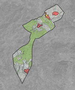
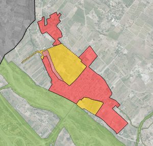
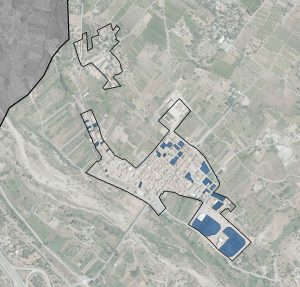
The municipality of Albalat dels Tarongers is located in the north of the province of Valencia, about 31 km from the provincial capital and 7 km from Sagunto, in the Camp de Morvedre region. The municipal term limits to the north and west with the municipality of Estivella, to the north and east with Sagunto, to the south with Gilet and to the west also with Náquera and Segart. It has an area of 21.35 km² and the main population center is Albalat dels Tarongers, with other small urban centers on both sides of the Palancia river, such as the La Caixa, Carretera de Segart and Pla de Pavía urbanizations. Likewise, scattered throughout the territory, there are isolated houses or even small groups of these built on rustic land.
Albalat dels Tarongers is nestled in the Sierra Calderona, a Natural Park located between the provinces of Castellón and Valencia. The municipality is crossed by the A-23 Sagunto-Somport highway and by the N-340 road, having direct access to both.
The existence of many scattered buildings and groups of houses without legalization, constitutes a territorial problem of great complexity, given the effects of all kinds that these houses cause.
The municipal term has archaeological evidence of its occupation since ancient times, while in the old town of the main town, Albalat dels Tarongers, highlights the Palau Senyoral D’Alabat , a Gothic palace-castle dating from the s. XIV and that retains much of its original structure. Under this building and the parish church, vestiges of the Roman era have been found.
Leaving aside the need to adapt local planning to the new legal framework that regulates spatial planning, urban planning, landscape, heritage and, in general, the main objectives of the new plan are summarized as follows:
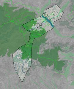
- From the environmental and landscaping point of view, the attribution to part of the rustic soil, of the degree of protection that is its own and necessary to safeguard its values, as well as the zoning of the rustic soil with the highest possible degree of detail, incorporating in the Same precise delimitation of all uses and, in particular, of those that entail a greater environmental impact. In this sense, the determinations of higher-order protection figures, in particular, those associated with the Sierra Calderona Natural Park, are transferred to management.
- Regarding undeveloped land , in addition to gathering all the sectoral-type determinations (livestock routes, hydraulic public domain, etc.), the emphasis is placed on the detailed identification of illegal buildings that occur throughout the territory ordered, distinguishing two types of situations: those that can be legalized, either jointly through Special Plans or in isolation and those that, because they are occupying specially protected land, cannot be and on which the measures will have to be applied legal requirements.
- The identification, according to official cartographies and after field visits, of the areas that present a high risk of forest fire throughout the southern part of the municipality (from the Palancia river, to the south), so that On the part of the competent administration, the appropriate measures are taken and also so that this circumstance is taken into account when evaluating the possible legalization of the homes most exposed to this risk.
- The preservation of areas where there are natural risks, of new growths, keeping only the sealed soils of historical origin.
- The intention of freezing the polynuclear model, avoiding increasing the land occupation system that existed until the approval of the NNSS, so that, in urbanizations, the policy followed in this plan has been not to increase land and, in In any case, “sew it” and order it from a more detailed cartography, which has allowed us to finish pointing out streets that were not mapped, to delimit some (small) areas subject to programming, etc. All this, within the framework of an analysis of the detailed management, but which has been necessary to incorporate from the outset.
- The adequacy of the growth forecasts for the sealed soil to the thresholds set in the ETCV and to the real expectations of the municipality, from a containment perspective. Specifically, it is renounced to increase the land destined for economic activities, while the residential land is oriented towards the two areas of natural growth of the population, such as the western part of the town and the vacant land between the industrial estate and the town residential.
- The identification of all local heritage and its protection in the corresponding Catalog of Protections, so as to guarantee its preservation, favor appreciation and respect for it by neighbors and visitors. In addition to the archaeological sites and the extraordinary building of the stately palace that presides over the image of the town and which may become the protagonist of the urban renewal of the river facade, in the town there is a Traditional Historic Center with a good urban layout, in the one that conserves many elements of vernacular architecture that must be preserved and protected. All this, in avoidance of the degradation of the urban scene and the trivialization of architecture, which has been suffered in recent decades.
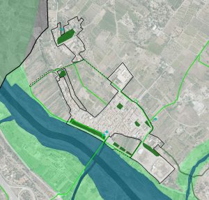
- The delimitation of the provisions for green areas and equipments. The plan also suggests some actions in terms of wheeled mobility , around the Albalat dels Tarongers hull , and from this towards the La Caixa area, which, although not specific to the plan (to the extent that its execution cannot be economically attributable to the development of the same), they can serve as a guide to the actions of other organizations, such as, for example, the Valencia Provincial Council, since they include concrete proposals contrasted with the city council, of little scope , but whose execution escapes the capacity d ad local.
- The incorporation of urban planning regulations adapted to all the current sectoral regulations, supra-municipal protection figures (Red Natura 2000) and current, contrasted and rigorous criteria for regulating this type of area. Ordinances concerning the building without altering the current typologies, becomes necesari to the implementation of ordinances of the Traditional Historical Nucleus that stop its degradation.
- The elaboration of an inclusive plan, which takes into account the most disadvantaged groups and where sustainable mobility is also favored, promoting the use of the bicycle for small urban displacements and also as a recreational exercise, thanks to the connection with the new section enabled of the Greenway of Ojos Negros . Within social policies, the possible transfer, in the long term, of the current educational center, whose position determines an inappropriate situation at the time of entry and exit to the same school population, to a new location within residential development able for urbanise Land, is an opportunity that can serve to structure the territory and the growth of the town, making the new school a dynamic element of the area.
DETAILS OF THE PROJECT
Locality: Albalat dels Tarongers (Valencia, Spain); Promoter: City Council of Albalat dels Tarongers; Municipal term area: 2,135 Ha.; Urban Land: 90 Ha.; Able for urbanise Land: 8 Ha.; Not able for urbanise land: 2,037 Ha.; Population cores: 4; Processing status: In process


