DESCRIPTION
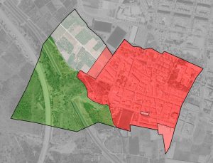
The municipality of Benirredrà is located in the region of La Safor, province of Valencia, about 70 km from the provincial capital, its urban nucleus is conurbed with that of Gandía (located in the eastern part). The municipality has an area of 0.39 km² and a population of 1570 inhabitants . The municipal term limits with the municipality of Gandía by all the sides. The delimitation has an irregular shape but assimilable to a rectangle of substantially uneven sides and its small area is occupied by the urban area, a small crop area and the eastern slope of Serra Falconera through which the AP-7 motorway and the road N-332.
In accordance with the Valencian urban planning legislation, the planning is divided into two independent documents and whose approval corresponds to the regional administration and the town hall, such as the Structural General Plan and the Detailed Ordination Plan.
In this context, the territorial model proposed is conditioned by the conurbation of Benirredrà and Gandia, municipality offering the first all necessary provisions in educational and health matters and also provides important productive areas in which the inhabitants of Benirredrà can find opportunities labor. This plan arises when NNSS have achieved their objectives, so that the targets for facilities and green areas have already been achieved, thanks to the development of its determinations.
The success in the management of land and the non-affectation to the public estate with the urban determinations, which defended the NNSS and so effectively executed the municipality of Benirredrà, mark an antecedent from which it is not necessary to deviate. We can only point out, as an element that should become the hallmark of the new plan, the commitment to a building regulation, which favors a higher quality architecture and more focused on concrete models and solutions, which manifest as an overcoming of the current disparity.
In this way, the objectives of the new planning are summarized as follows:
- The consolidation of the residential character of Benirredrà, as a space with its own identity, despite its small size, characterized by tranquility, the quality of urban spaces, accessibility and proximity to public facilities and medium and low density typologies .
- From the environmental and landscape point of view, the attribution to part of the rustic land, the degree of protection that is proper and necessary to safeguard its values, as well as the classification as a common rural agricultural area, from the western part of the municipality, dedicated to the garden and which constitutes the strategic land reserve of Benirredrà .
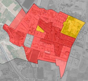
- Administration of the common agricultural rural area in the western part of the municipality , in a way prudent and content, to the treated l únic or soil that remains to Benirredrà , for future expansions . Consequently, the proposal of urban land growth through the management of a small fraction of the land adjacent to those already urbanized in the west (UER-03, next to Carrer Llarguer), which will allow the culmination of the existing urban fabric through a small urban development that does not involve more than one line of building blocks, in accordance with article 25.2.b) of the LOTUP.
- The requalification of industrial land on urban land, located south of the municipality (UER-02), in order to consolidate residential use in that area, where the productive activity has concluded and there is appropriate land to accommodate a use residential and contribute to obtain, in the framework of land programming, a new public green area.
- The maintenance by growth of the number of new homes below the threshold of the 100 units , for the purposes of article 33.3 of the LOTUP
- The promotion of a somewhat denser building in the southern part, adjacent to Gandía (UER-02) in a block of three or four heights and less buildable in the western part (UER-3), with single-family houses with two floors and diverse typologies
- The identification of all the local heritage and its protection in the corresponding Catalog of Protections, so that its preservation is guaranteed, appreciation and respect for it by neighbors is favored and this wealth is interpreted as consolidating a friendly locality with higher quality .
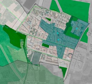
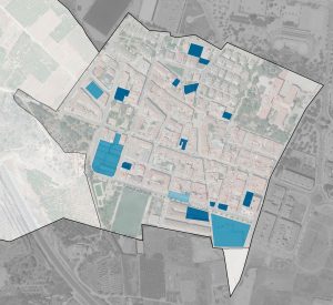
- The delimitation, in its fair measure, of the forecasts in terms of green areas and other equipment.
- The incorporation of urban planning standards adapted to all current sector regulations, supramunicipal protection figures and current, contrasted and rigorous criteria for regulating this type of areas. Rules that must continue to contribute to the actions of improvement and requalification of urban spaces that the city council has been promoting in recent years.
- The elaboration of an inclusive plan, which takes into account the most disadvantaged groups and in particular, the elderly, with an increasing weight in the municipality as a whole.
DETAILS OF THE PROJECT
Locality: Benirredrà (Valencia, Spain); Promoter: City Council of Benirredrà; Municipal term area: 39 Ha.; Urban Land: 20 Ha.; Able for urbanise Land: 0 Ha.; Not able for urbanise land: 19 Ha.; Population cores: 1; Processing status: In process


